
From a Distance: The meandering Sprague River at Bates–Morse Mountain
This photo shows part of the Sprague River and salt marsh within the coastal Bates–Morse Mountain Conservation Area.
Fun facts are courtesy of Whitehouse Professor of Geology Dyk Eusden ’80 and Professor of Geology Beverly Johnson.
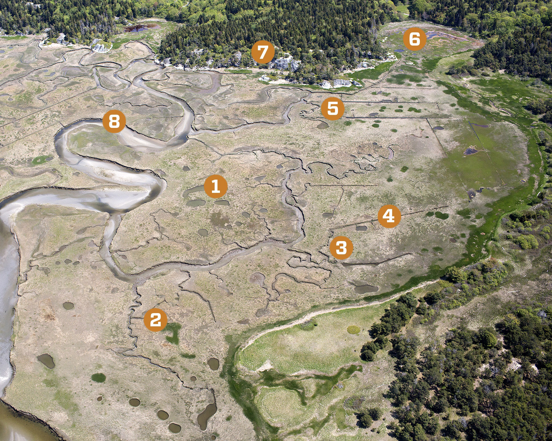
1. Pooling Resources
Pools are natural features of the marsh and provide habitat for wildlife.
2. Water Way
Spring floods cover the marsh, allowing marine life to move between pools and tidal channels.
3. Long and Winding
These winding channels are naturally occurring “meanders” and help drain the marsh.
4. Last Ditch
These straight ditches were designed to drain pools and reduce standing water. People have been ditching marshes for centuries, initially to harvest the marsh grasses for hay and then more recently, in the 1970s, to control mosquitos.
5. Plugging Along
The ditches eliminated vital habitats, prompting repair efforts with earthen “ditch plugs” in the early 2000s.
6. Tiding Over
A failed restoration attempt with a too-effective ditch plug resulted in this area being cut off from beneficial tides.
7. Rock of Ages
Morse Mountain granite is thought to be Paleozoic in origin — up to 350 million years old.
Granite cut from Maine quarries is found in buildings and structures around the country, including the Washington Monument.
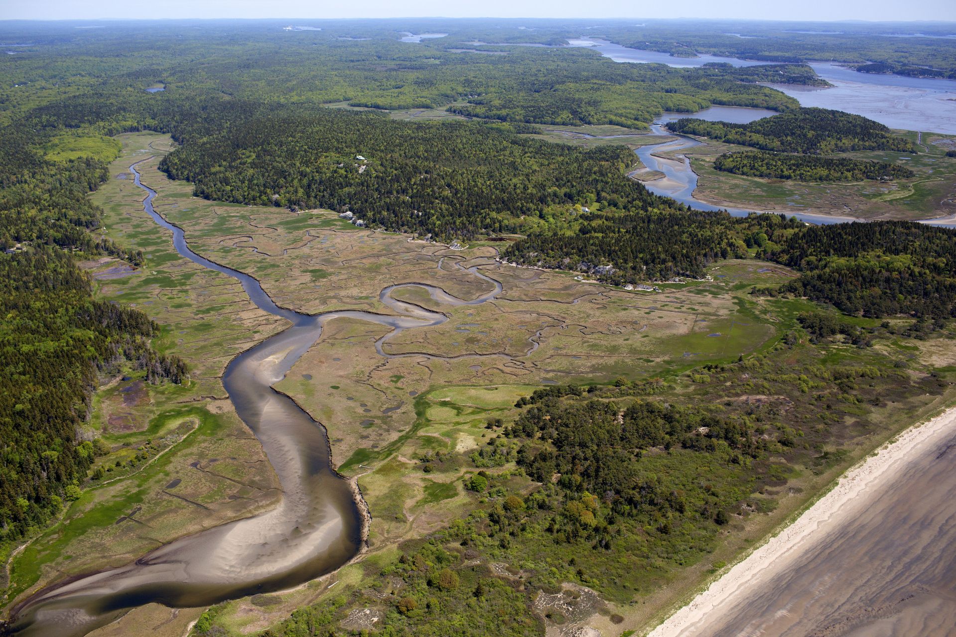
8. Destination: Ocean
The natural channel of the 2.5-mile Sprague River winds through the marsh to the Atlantic.
9. Keeping in Dune
A large and mostly hidden dune field, known as parabolic dune field for its shape, runs parallel to and set back from the beach.
In the image below, one of the parabolic fields is at the lower center, nestled within the darker green bushes and trees:
Categories Academic Life Science and technology